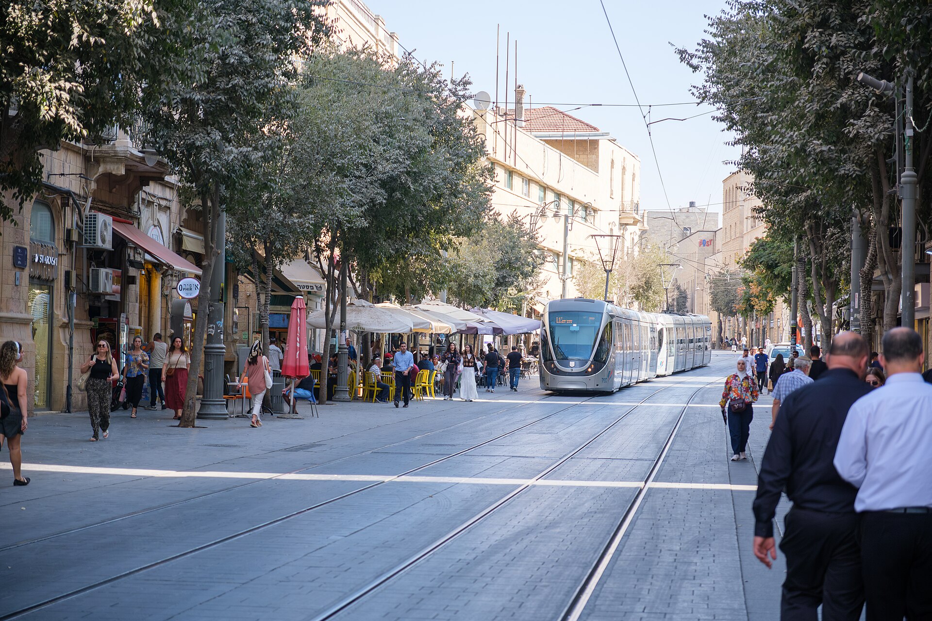
Stand on Jaffa Road on a weekday morning and the tram arrives almost silently, a long silver snake sliding between café tables and pedestrians on a street where cars are no longer allowed. The doors open, a woman with a pram rolls straight on, a soldier with a rifle steps aside for her, two Hasidic boys and a group of Italian pilgrims squeeze in behind, and off it goes towards the Old City walls. For fifteen years the Jerusalem light rail was a single line. On 21 August 2026 it became a network, and for visitors that makes it more useful than it has ever been.
This guide covers both lines: where the Red Line and the new Green Line go, which stops matter for sightseeing, how to pay, when they run and stop, what happens on Shabbat, and what is still being built. For buses, taxis, walking and the other ways of getting around, our full Jerusalem transport guide is the overview. Routes and opening dates were checked in September 2026, three weeks after the Green Line opened; station details and timetables on a new line tend to change in the first months, so check the operator’s app or Moovit before you ride.
Jerusalem Light Rail at a Glance
| Red Line (L1) | Green Line (L3 section) | |
|---|---|---|
| Opened | 2011; extended at both ends in February 2025 | 21 August 2026 |
| Route | Neve Ya’akov in the north to Hadassah Ein Kerem in the southwest, through the city centre | HaTurim, by Mahane Yehuda, to Malha in the south |
| Length | About 22.5 km | About 7 km, 13 stations |
| Best for visitors | Old City (Damascus Gate and City Hall), Mahane Yehuda, Central Bus Station and the fast train, Mount Herzl and Yad Vashem | Hebrew University Givat Ram, the Botanical Gardens, Teddy Stadium, Pais Arena, Malha Mall |
| Shabbat | No service from Friday afternoon until Saturday night, or on Jewish holidays | |
| Payment | Rav-Kav card or an approved app, with free transfers within a time window; contactless card acceptance has been rolling out. Same fare as a city bus | |
| Coming next | Extensions towards Gilo in the south and Mount Scopus in the north, due from late 2026 into 2027 | |
The Red Line
The Red Line is the one visitors actually use, and for good reason: it runs straight through everything that matters. It opened in 2011, and in February 2025 it was extended at both ends, north to Neve Ya’akov and southwest to the Hadassah Ein Kerem medical centre, taking it to about 22.5 kilometres. It carries around 200,000 passengers a day.
From north to south, the stretch that matters to a visitor runs roughly like this:
- Ammunition Hill, the memorial and museum to one of the fiercest battles of the 1967 war.
- Shivtei Israel, at the edge of the Musrara neighbourhood, a short walk from the New Gate and the Christian Quarter.
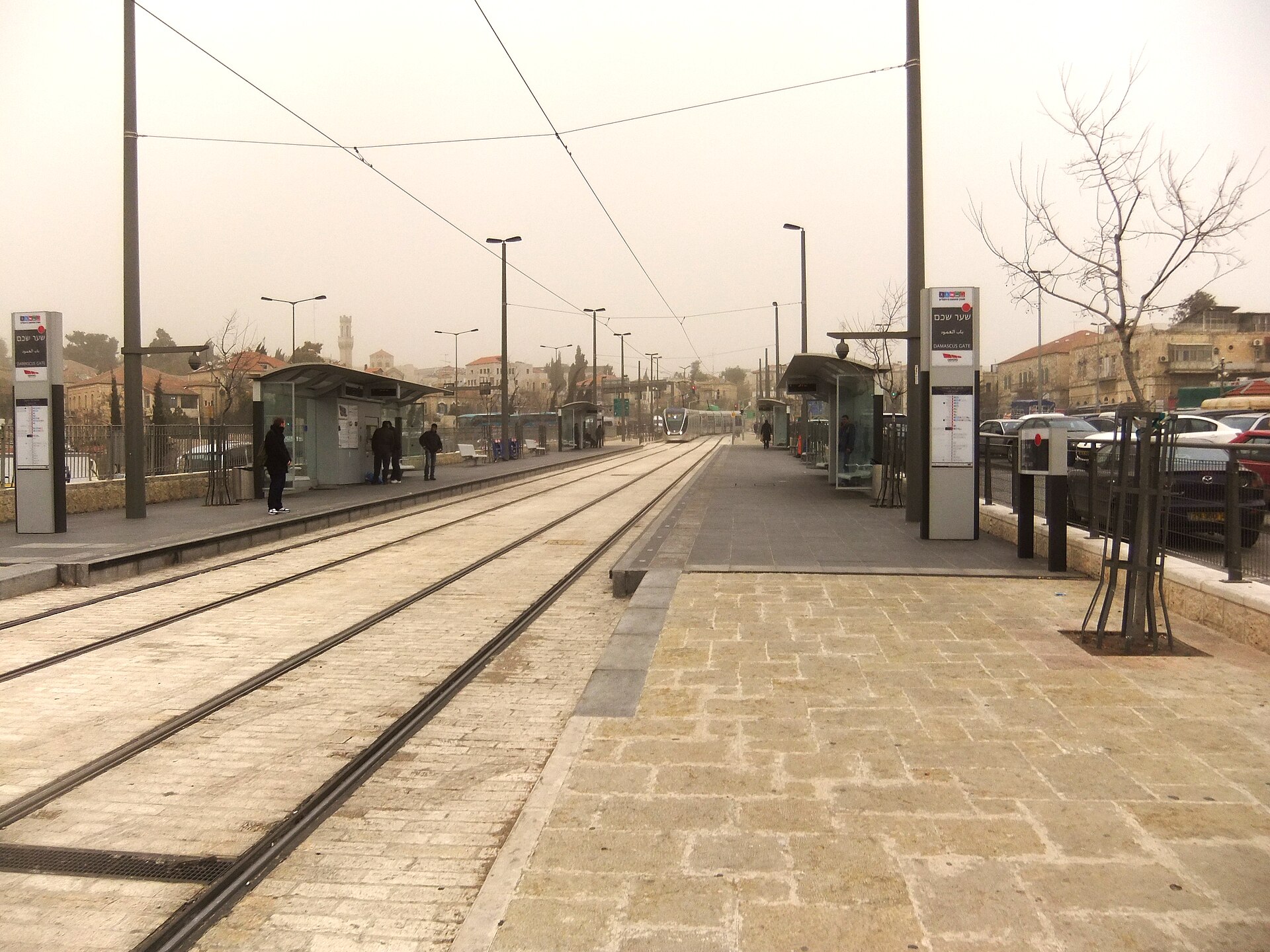
- Damascus Gate (Sha’ar Shkhem in Hebrew, Bab al-Amud in Arabic), right beside the Old City’s most dramatic entrance, for the Muslim Quarter and the Via Dolorosa.
- City Hall, at Safra Square, about ten minutes’ walk from Jaffa Gate along the walls.
- Jaffa Center, by King George Street, the heart of the downtown shopping and café district.
- Mahane Yehuda, for the market.
- Central Station, for the Central Bus Station and the Yitzhak Navon railway station, with fast trains to Ben Gurion Airport and Tel Aviv.
- Mount Herzl, for Yad Vashem, the Herzl Museum and the national cemetery.
- Hadassah Ein Kerem, the terminus at the hospital, whose synagogue has the famous Chagall windows.
North of the city centre the Red Line runs through a mix of Palestinian neighbourhoods, including Shuafat and Beit Hanina, and Jewish neighbourhoods, including Pisgat Ze’ev and Neve Ya’akov. Those last two were built by Israel beyond the pre-1967 line; Israel regards them as neighbourhoods of its capital, while most of the international community regards them as settlements. For most visitors this part of the line is simply the route to nowhere in particular, but it explains why the tram is a genuinely shared space, and occasionally a contested one.
The Green Line
After years of delays, the first section of the Green Line opened on 21 August 2026, turning a single line into Israel’s first urban light rail network. The section in service, known in planning documents as L3, runs about seven kilometres with 13 stations, from HaTurim on Jaffa Road near the Mahane Yehuda market, where it meets the Red Line, south through the Givat Ram campus of the Hebrew University, past the Botanical Gardens and Gazelle Valley Park, and through the Pat and Givat Mordechai neighbourhoods to Malha.
For visitors, it opens up the south-west of the city:
- Hebrew University’s Givat Ram campus, and the government quarter around it. The Israel Museum, the Knesset and the Bible Lands Museum are in this part of the city; check Moovit for the nearest Green Line stop and the walk from it, which on these hilly streets can be longer than it looks on a map.
- The Jerusalem Botanical Gardens, one of the city’s quieter pleasures.
- Gazelle Valley Park, an urban nature park where wild mountain gazelles graze in the middle of the city.
- Teddy Stadium and Pais Arena, for football, basketball and big concerts, which were notoriously hard to get to before.
- Malha Mall, one of the largest shopping centres in the city.
The Green Line will eventually be much longer. Extensions from the Central Bus Station area south to Gilo, and north to the Hebrew University’s Mount Scopus campus, are due from late 2026 into 2027, although official dates have moved before and may move again. A third line, the Blue Line, is also planned. Until more of the network opens, the Green Line is most useful for events, the museums of Givat Ram and a few specific destinations rather than for everyday sightseeing.
Which Stop for Which Sight
| Where you want to go | Line and stop | From the stop |
|---|---|---|
| Old City: Muslim Quarter, Via Dolorosa | Red, Damascus Gate | Straight across the road |
| Old City: Jaffa Gate, Christian and Armenian Quarters, Tower of David | Red, City Hall | About 10 minutes’ walk |
| Mamilla Mall | Red, City Hall | About 10 minutes’ walk |
| Downtown: Ben Yehuda Street, Zion Square | Red, Jaffa Center | Right there |
| Mahane Yehuda market | Red, Mahane Yehuda (Green Line riders use HaTurim) | Right there |
| Train to Ben Gurion Airport or Tel Aviv | Red, Central Station | Navon station entrance across the road; the platforms are deep underground, so allow 10 minutes |
| Intercity buses | Red, Central Station | Across the road |
| Yad Vashem, Herzl Museum | Red, Mount Herzl | About 10 to 15 minutes’ walk |
| Chagall Windows | Red, Hadassah Ein Kerem | Inside the hospital complex |
| Ammunition Hill | Red, Ammunition Hill | Right there |
| Botanical Gardens, Gazelle Valley | Green | Check the nearest stop on Moovit |
| Teddy Stadium, Pais Arena, Malha Mall | Green, Malha end | A short walk |
What the Light Rail Does Not Reach
Just as useful to know. The tram does not go to the German Colony and Emek Refaim, the Haas Promenade, the Mount of Olives, the City of David, Mount Zion or the village of Ein Karem, which is a bus or taxi ride from the Hadassah terminus rather than a walk. It does not run inside the Old City, which is car-free and mostly stepped, and has to be walked. For all of these, use buses, taxis or your feet; our transport guide explains the options, and the attractions map shows how it all fits together.
How to Pay
Jerusalem’s light rail uses the same fare system as the city’s buses, and one fare includes free transfers between tram and bus, or tram and tram, within a time window. That makes the new interchange at HaTurim particularly handy.
- Rav-Kav card. Israel’s rechargeable transit smartcard, sold and topped up at machines at stops and at the Central Bus Station. It works on buses and trains nationwide. An anonymous card is fine for a short visit.
- Phone apps. Several approved apps, including Moovit and Rav-Kav Online, let you pay by phone with a card linked to the app.
- Contactless bank cards. Acceptance of contactless cards directly on validators has been rolling out across Israeli public transport. Look for the contactless symbol on the validator and follow the instructions at the stop.
Whatever you use, validate every ride as the signs instruct. There are no ticket gates, but inspectors board regularly, and riding without a valid fare brings a fine that no amount of tourist confusion will talk away. Our guide to Jerusalem on a budget covers the fare and other ways to save.
When It Runs, and When It Does Not
| Day | Service |
|---|---|
| Sunday to Thursday | From early morning until around midnight, every few minutes at peak times and less often late in the evening |
| Friday | Morning and early afternoon only; the last trams run well before Shabbat begins at sunset |
| Saturday | No service during the day; trams resume after Shabbat ends, usually some time after nightfall |
| Jewish holidays | No service on the holiday itself, and reduced service on the eve |
| Yom Kippur | Nothing moves at all |
Friday afternoon catches visitors out more than anything else. If you are planning to take the tram back from Yad Vashem or Mahane Yehuda on a Friday, go early. Our guide to Shabbat in Jerusalem explains what closes and what stays open, and the Yom Kippur guide covers the one day a year when the whole city stops.
Disruptions
Service is suspended on sections of the line from time to time for works, especially while the network is being extended, and has been suspended entirely for several days on occasion. It is also halted or diverted during major events and security incidents. On Jerusalem Day, when the Flag March passes through the city centre and Damascus Gate, expect disruption on the Red Line in the afternoon and evening; our Jerusalem Day guide explains why. The operator posts service changes on its app and social channels, mostly in Hebrew; Moovit usually reflects them in English.
Riding Tips
- Board at any door. Trams are long; walk down the platform if the first carriage is packed.
- Announcements are in Hebrew, Arabic and English, and stop names are displayed on screens.
- Rush hour is crowded, especially between the Central Station and the city centre in the morning, and around the Hebrew University in term time.
- Give up seats to older passengers, pregnant women and people with disabilities. It is expected.
- Keep bags in front of you in crowds, as on any metro in the world.
- Security staff patrol some stops and trams. Bag checks are not routine, but are not unusual either.
- Expect everyone. The tram is one of the few places in Jerusalem where all of its communities ride side by side. It is worth looking up from your phone.
Accessibility
The trams are low-floor with level boarding from the platforms, making the light rail the most accessible public transport in Jerusalem for wheelchair users, people with limited mobility and parents with prams. Stops have ramps. The difficulty tends to be what lies beyond the stop rather than the tram itself: Jerusalem is steep, the Old City is stepped, and Navon railway station is very deep, reached by lifts and long escalators. Our Jerusalem accessibility guide covers the rest, and Jerusalem with kids has advice for families.
Getting to and From the Airport
The light rail and the airport train make a very good pair. From Ben Gurion, the train to Jerusalem Yitzhak Navon takes around half an hour; from Navon, walk across to the Central Station tram stop and ride the Red Line into the centre, with Jaffa Center, City Hall and Damascus Gate a few stops away. Neither train nor tram runs on Shabbat, so arriving on a Friday evening or Saturday means a taxi or sherut. Our airport transfer guide and the page on getting from Tel Aviv to Jerusalem have the details.
A Light Rail Day in Jerusalem
You can build a very good day around the Red Line alone, with no taxis at all:
- Morning: ride to Damascus Gate and walk into the Old City, through the Muslim Quarter to the Via Dolorosa and the Church of the Holy Sepulchre. Our Old City guide will help.
- Lunch: walk out through Jaffa Gate to City Hall, ride to Mahane Yehuda and eat in the market. See our Mahane Yehuda market guide.
- Afternoon: continue to Mount Herzl for Yad Vashem. Allow three hours, and check its closing time.
- Evening: ride back to Jaffa Center for dinner downtown. Our guide to Jerusalem at night has ideas.
On a second day, the Green Line makes a gentler plan easy: the Botanical Gardens or Gazelle Valley in the morning, the museums of Givat Ram in the afternoon, and a match or concert at Teddy Stadium or Pais Arena in the evening if there is one on.
Five Mistakes Visitors Make on the Light Rail
- Getting off at City Hall and expecting the Old City. The stop is named for Safra Square, not for a gate. Jaffa Gate is a ten-minute walk along the walls, which is pleasant, but not what most people expect.
- Riding without validating. Buying a fare and validating it are not always the same step, and an inspector will not accept a card that was never tapped on board or at the stop.
- Trusting a Friday afternoon plan. The last trams before Shabbat leave far earlier than first-time visitors expect. Anything after lunch on a Friday needs a taxi as back-up.
- Treating the Green Line as a sightseeing line. For now it is a line for students, shoppers, football fans and commuters. It is excellent for Teddy Stadium, the Botanical Gardens and Malha, and not much use for the classic sights until the extensions open.
- Allowing five minutes for the train. The Central Station tram stop is close to Navon railway station, but the platforms are among the deepest in the world, reached by long escalators and lifts. Allow at least ten minutes from tram to train, more with luggage.
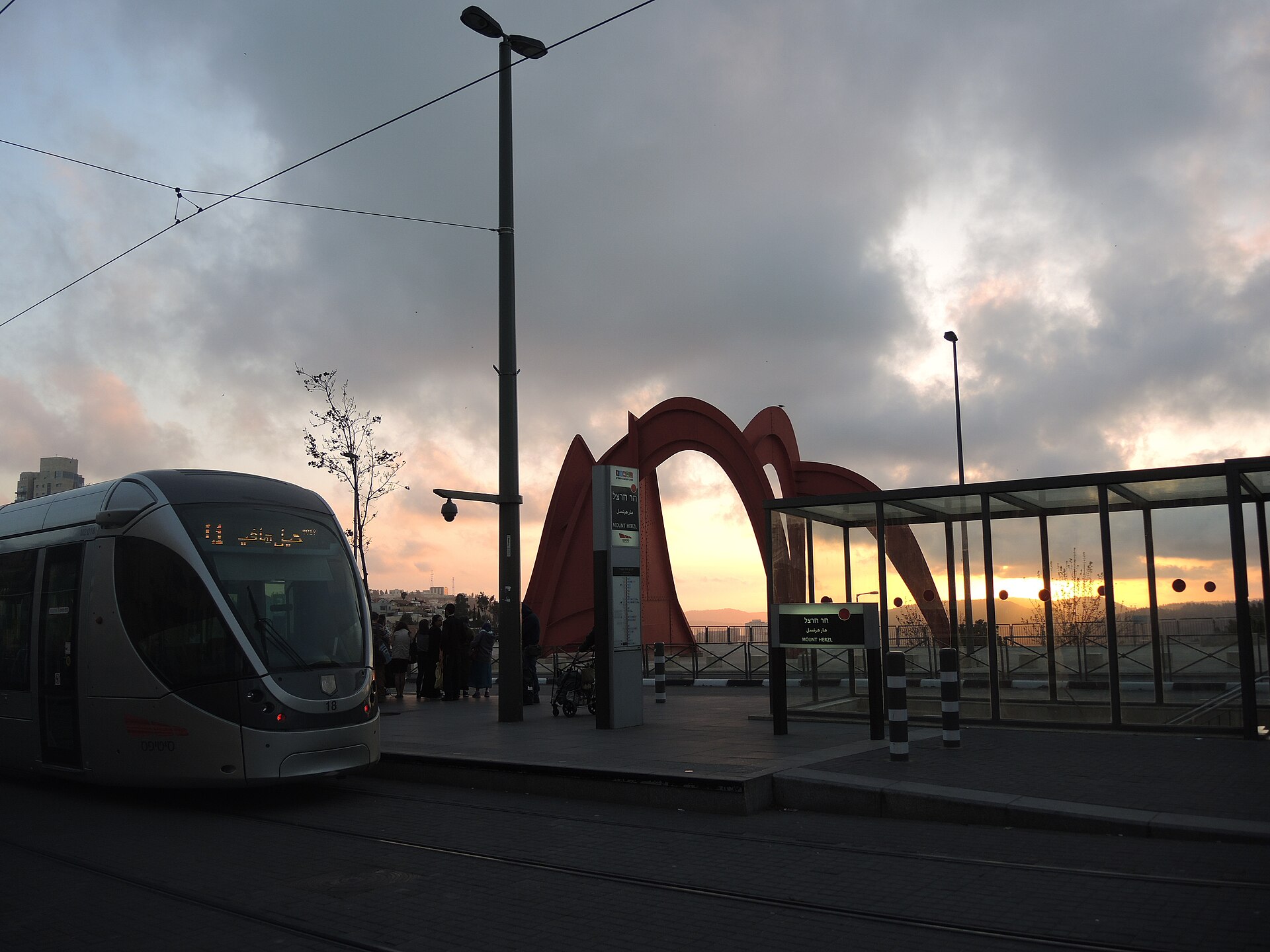
The Mount Herzl stop is one of the most useful on the Red Line for visitors, because it serves two of the country’s most important national sites. Yad Vashem is a walk of 10 to 15 minutes away, and Mount Herzl itself, Israel’s national cemetery with Herzl’s tomb and the graves of its prime ministers, starts right by the stop, beside Alexander Calder’s red stabile.
Final Word on the Jerusalem Light Rail
The Red Line has always been the easiest way for a visitor to get between the Old City, downtown, the market, the train station and Yad Vashem, and it still is. The Green Line is not yet a game-changer for sightseeing, but it has made the south-west of the city reachable for the first time, and when the extensions arrive it will be. Buy a Rav-Kav or set up an app on day one, remember Friday afternoon, and walk the last stretch into the Old City. Then read our full Jerusalem transportation guide for everything else that moves, and our first-timer’s guide for how the city works.
Photo Credits
A Red Line tram on Jaffa Road: Jerusalem Light Rail (Red Line) on Jaffa Road, 5 November 2025 01 by מקף־עברי, CC BY-SA 4.0, via Wikimedia Commons.
The Damascus Gate light rail stop: Atraindamacasgate7968 by יעקב, CC BY-SA 3.0, via Wikimedia Commons.
The Mount Herzl stop and Calder sculpture: Jerusalem Mont Herzl Tramway Calder stabile DSCN4345 by Wuyouyuan, CC BY-SA 4.0, via Wikimedia Commons.
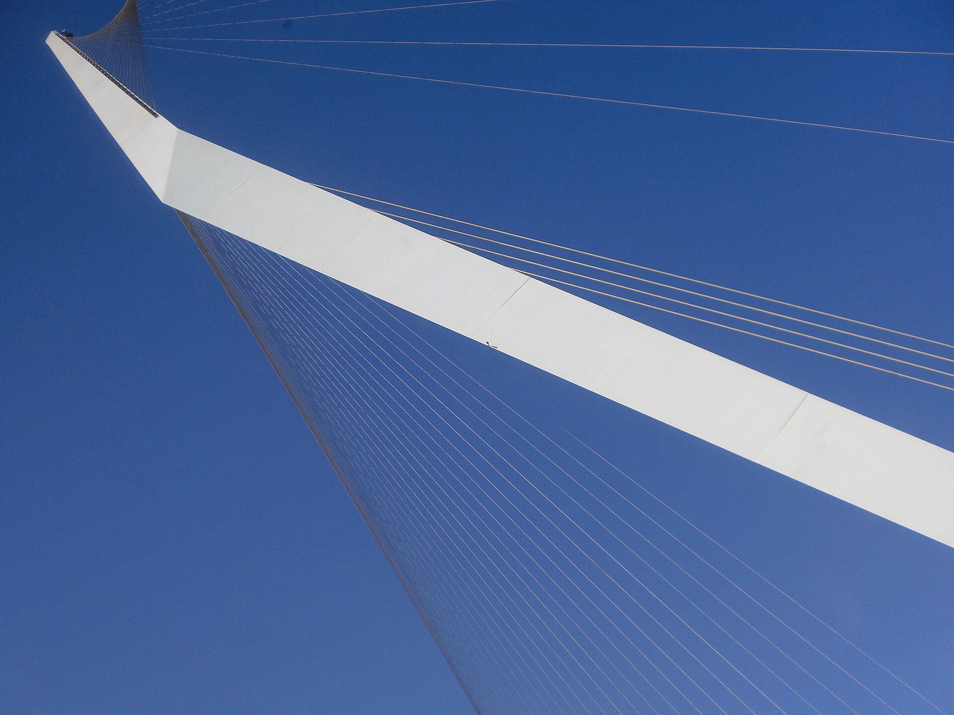
The Chords Bridge: Chords Bridge Jerusalem (Bridge of Strings, גשר המיתרים) by ASI ROKSAR, CC BY-SA 4.0, via Wikimedia Commons.