The Jerusalem Trail is a 42-kilometer marked circuit that loops the city, stitching together forests, springs, abandoned villages, archaeological valleys, and the walls of the Old City. It is marked with white-blue-white blazes, was developed around 2010 by the Jerusalem Walking Society, and connects to the much longer Israel National Trail. You can walk the whole loop over three to four days or pick off individual sections as half-day outings, and because the route hugs the city, most segments are reachable by public transport. This guide to Jerusalem Trail hiking covers the route, the best day-hike sections, multi-day plans, the all-important water and heat advice for summer, and exactly how to get to the trailheads.
The trail is a rare thing: a serious hiking route that runs through a major city, so you move from pine forest to a market lane to a desert-edge valley in the space of a few hours. For the wider picture, this page sits alongside our hiking and outdoor activities guide, our walks that work with younger children, and our Sataf trail guide.
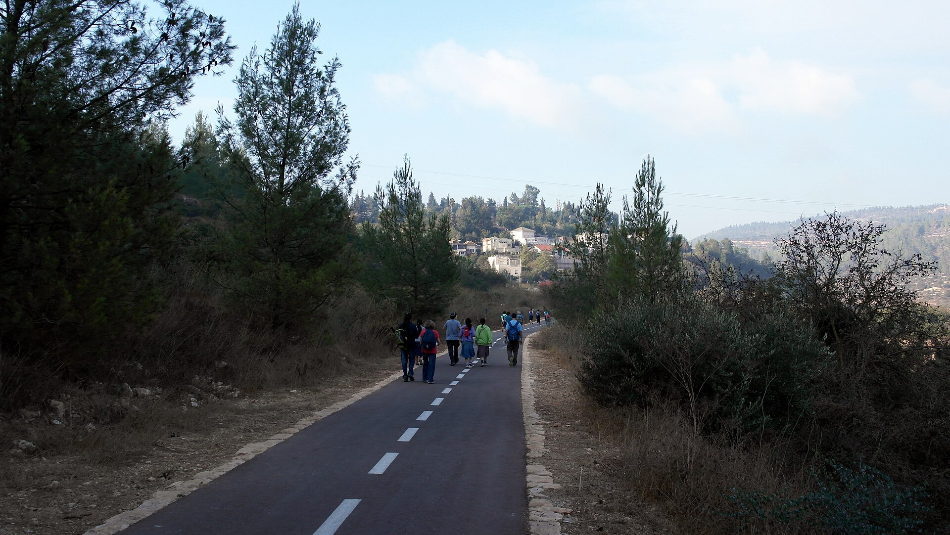
The Jerusalem Trail at a Glance
The route is circular, so there is no official start or finish; you join wherever it suits you and walk in either direction. The full loop covers about 42 kilometers with roughly 1,500 meters of cumulative climbing, which is why it is rated moderate overall even though individual stretches range from flat valley paths to steep stair-climbs. The trail passes the Jerusalem Forest, the spring valley of Ein Karem, the abandoned village of Lifta, the Refaim (Rephaim) Valley in the south, the Old City walls, and the Mount of Olives, with long views over the city from the high points.
| Detail | Information |
|---|---|
| Total length | About 42 km, circular loop |
| Trail blazes | White-blue-white stripes |
| Cumulative climb | Roughly 1,500 m over the full loop |
| Difficulty | Moderate overall; sections easy to strenuous |
| Time for full loop | 3-4 days relaxed, 2 days hard |
| Day sections | Typically 4-6 km, 1.5-3 hours each |
| Best seasons | Spring (Mar-May), autumn (Sep-Nov) |
| Access | Many segments reachable by bus or Light Rail |
Following the Blazes
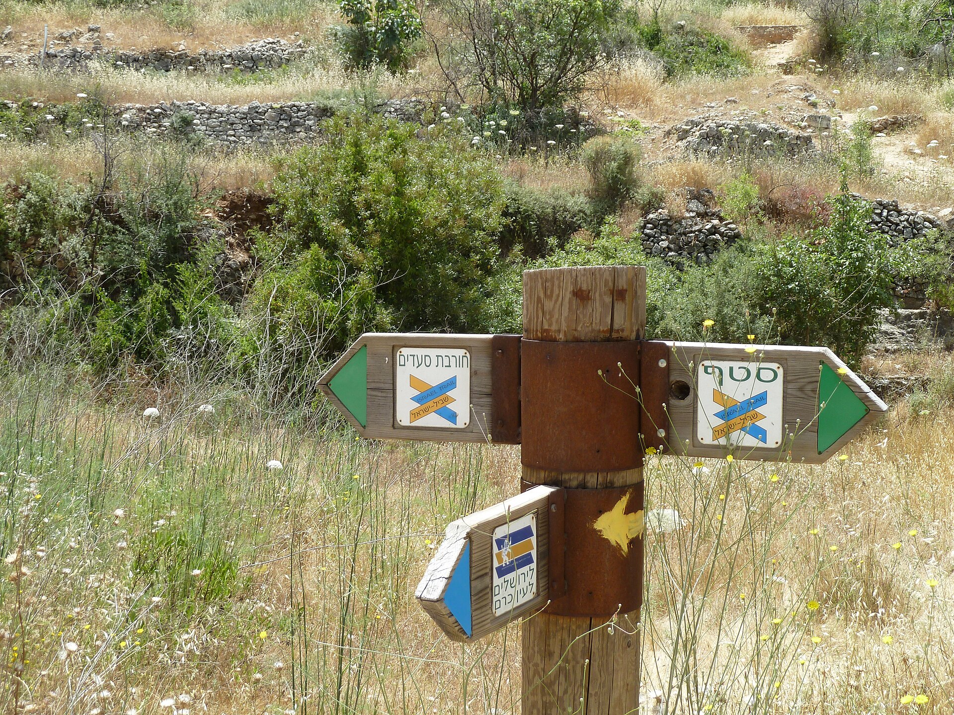
The Jerusalem Trail uses a painted white-blue-white blaze on rocks, walls, posts, and trees. In Israel, trail markers are three horizontal stripes: the two outer stripes are always white, and the center stripe gives the route its color, here blue. Where the Jerusalem Trail shares ground with the Israel National Trail, you will also see the national route’s distinctive orange-white-blue blaze. Markings are generally good, but they can be sparse where the trail threads through built-up areas, so it is worth carrying offline navigation. The Israel Trail app and standard mapping apps both cover the route and help when the path crosses roads or runs along city streets.
Best Sections for Day Hikes
Most visitors hike the Jerusalem Trail in pieces, choosing a section that fits the morning and lets them bail out to a bus afterward. These are the most rewarding stretches, with rough distances and timings; treat the times as moving time and add margin for stops, heat, and navigation.
Mount Herzl to Ein Karem (about 6 km)
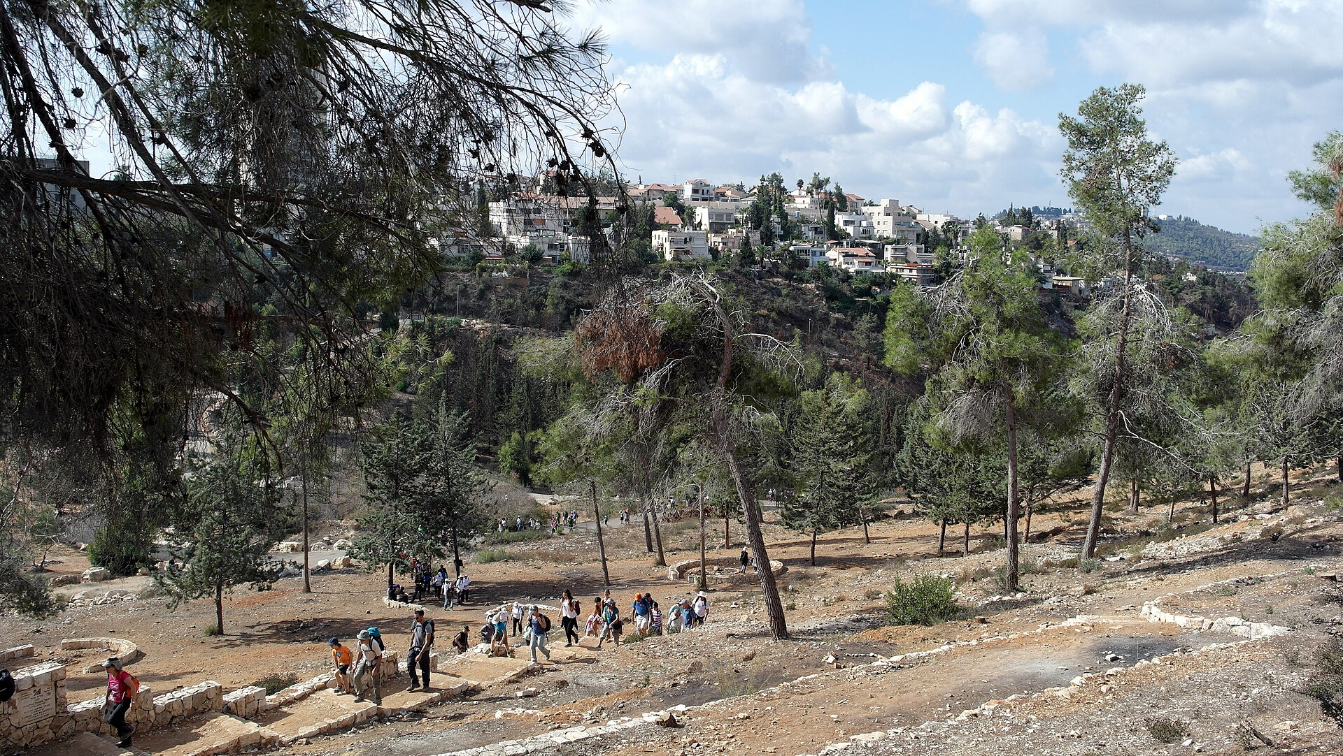
This is the classic introduction, descending through the Jerusalem Forest into the village of Ein Karem in roughly two to three hours at a moderate effort. It mixes shaded forest paths with a cultural payoff at the end: churches, cafes, and the spring. Start at the Mount Herzl Light Rail stop and finish in Ein Karem, where you can eat lunch and catch a bus back. For more on the destination, see our Ein Karem guide.
Lifta and the Hinnom Valley (about 5 km)
A roughly two-hour walk that drops into Lifta, an abandoned stone village with old terraces and a spring-fed pool, then follows the Hinnom Valley below the Old City walls. The descent is moderate and the surroundings are quiet and atmospheric. The Lifta spring is not a treated drinking source, so carry your own water.
Mount of Olives (about 4 km)
The Mount of Olives section is short but climbs to the trail’s high ground, with the most famous panorama over the Old City and the Temple Mount. It passes near the Garden of Gethsemane and the slope’s churches and cemeteries. Allow ninety minutes to two hours, dress modestly for the religious sites, and read our Mount of Olives guide and Garden of Gethsemane guide before you go.
Old City Walls to the Tzurim Valley (about 6 km)
This longer leg, around two and a half hours, links the Old City ramparts with the Tzurim (Emek Tzurim) Valley archaeological park on the eastern side. It blends history with greenery and is a good choice when you want distance without serious elevation. Watch the markings carefully where the route crosses busy roads.
Refaim Valley (about 5 km)
The Refaim Valley section in the south is the easiest, a roughly two-hour valley walk that connects with the popular Train Track Park (the converted railway path) and the southern neighborhoods. It is mostly flat and shaded in places, which makes it the friendliest option in warm weather and the best pick for families with younger children.
Walking the Full Loop
The advantage of a city loop is that you sleep in the same bed every night. Because the trail never strays far from the city, you can base yourself at one hotel and return each evening by bus or Light Rail, then pick up where you stopped the next morning. A relaxed three-day split runs roughly 13 to 15 kilometers per day; a hard two-day push covers the northern half one day and the southern half the next, but those are long days that are punishing in summer heat.
Sample Three-Day Split
- Day 1: Mount Herzl through Ein Karem toward Lifta (roughly 15 km).
- Day 2: Lifta to the Old City and up to the Mount of Olives (roughly 14 km).
- Day 3: Mount of Olives through the Refaim Valley back to Mount Herzl (roughly 13 km).
Because the trail returns to the city each day, you can shorten any stage by ending at a transit stop and resuming there. Build a Jerusalem Trail hiking plan around the weather and your fitness rather than forcing a fixed daily distance.
The Israel National Trail Connection
The Israel National Trail is the country’s flagship long-distance footpath, running roughly 1,000 kilometers from the far north to Eilat on the Red Sea, and it has been named among the world’s great long trails. It passes through the Jerusalem area and shares sections with the city loop, marked with the orange-white-blue national blaze. From Jerusalem, dedicated thru-hikers head north toward the Galilee or south through the desert, but those are multi-week commitments. For a shorter taste of that landscape, our Judean Desert jeep and hiking trips run from the city in a day. For a day visitor, the practical takeaway is that some of the Jerusalem Trail’s prettiest forest stretches double as part of the national route.
Water, Heat, and Staying Safe
Summer in Jerusalem is hot and dry, regularly into the mid-30s Celsius (mid-90s Fahrenheit), and the trail’s forest shade is patchy. The single most important rule is to carry enough water: plan on two to three liters per person for a half-day section and more for a full day, because the springs you pass (Lifta, Ein Karem) are not treated for drinking. From June through August, start by around 7am, aim to be off the exposed stretches by early afternoon, and treat midday as a break in shade or a cafe stop rather than hiking time.
A few more practical safety notes. Wear closed hiking or trail shoes, a hat, and sunscreen, and pack a light layer for cool mornings in spring and autumn. Tell someone your route and expected return, and keep your phone charged; cellular coverage is reliable across most of the loop. Stay on the marked path, and remember that the route runs through a real city: it passes residential neighborhoods, and some eastern sections run near checkpoints or through East Jerusalem, so use common sense, dress modestly through religious areas, and keep noise down on Shabbat. If anything feels uncertain on a given day, stick to the central and western forest sections.
Best Time to Hike
Spring, from March to May, is the prime window: mild temperatures and wildflowers across the hills. Autumn, September to November, is the other sweet spot, cool and dry once the summer heat breaks. Summer is doable only with early starts and serious hydration, and the midday hours are genuinely uncomfortable. Winter, December to February, can be pleasant between rain spells, but trails turn muddy and slick after storms. On any Friday, plan to finish before the afternoon, when Jewish neighborhoods quiet down ahead of Shabbat and transport thins out; our travel tips explain the Shabbat rhythm in detail.
What to Pack
- Water: 2-3 liters per person for a half day; more for full days. Springs are not for drinking.
- Sun protection: hat, sunglasses, high-SPF sunscreen.
- Footwear: closed hiking or trail shoes with grip.
- Snacks: fruit, nuts, sandwiches; few shops on the wilder stretches.
- Layer: a light jacket for cool spring and autumn mornings.
- Navigation: the Israel Trail app or an offline map as backup to the blazes.
- Basics: small first-aid kit, charged phone, some cash.
Maps, Apps, and Local Resources
For navigation, the Israel Trail app provides GPS tracking for both the city loop and the national trail, and it is the most reliable backup when blazes thin out in town. The Jerusalem Walking Society, which developed the trail, publishes route information, and the Society for the Protection of Nature in Israel (SPNI) is a good source for guided walks and current trail conditions. If you would rather not navigate alone, joining a guided section hike removes the route-finding worry; our Jerusalem tours guide points to organized options.
Seeing the City on Foot
Jerusalem Trail hiking shows you a side of the city most visitors miss, linking forest, spring, valley, and ancient wall in a single walk. Pick a section that fits your day, respect the summer heat with an early start and real water, and let the blazes lead. To plan the rest of your outdoor time, use our hiking and outdoor guide, the Sataf trail guide, and the easy-going hikes for families.
Photo Credits
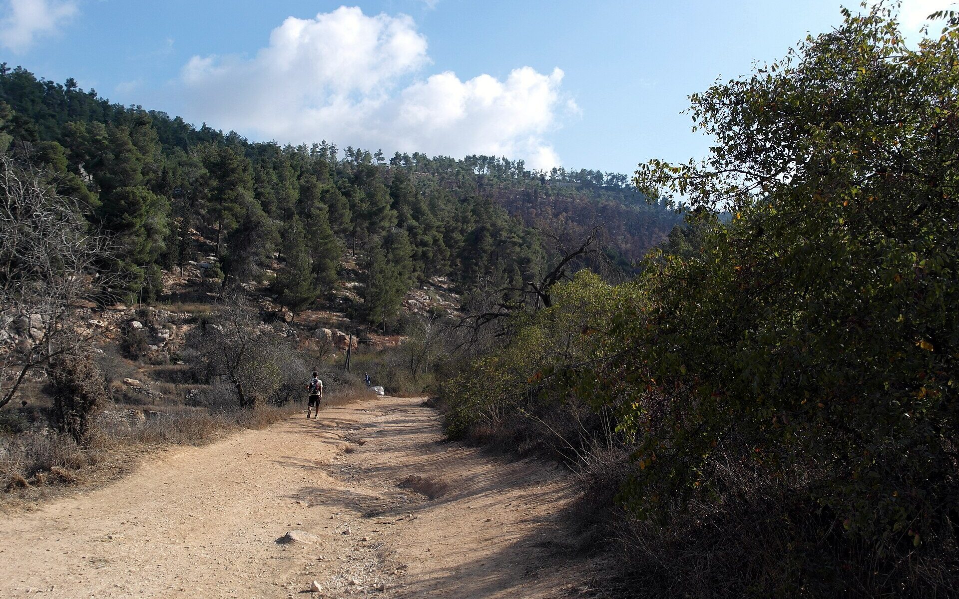
Dirt trail in the Jerusalem Forest: Jerusalem March 2014 (15528178296) by RonAlmog from Israel (ישראל), CC BY 2.0, via Wikimedia Commons.
Walkers on the Jerusalem Trail in the Jerusalem Forest: Jerusalem March 2014 (15528216116) by RonAlmog from Israel (ישראל), CC BY 2.0, via Wikimedia Commons.
Jerusalem Trail and Israel National Trail signpost near Ein Kerem: Hadassah Trail P1150507 by Deror_avi, CC BY-SA 3.0, via Wikimedia Commons.
Autumn walk in the Jerusalem Forest: Jerusalem March 2014 (15549159381) by RonAlmog from Israel (ישראל), CC BY 2.0, via Wikimedia Commons.